
The Jogasaki Coastline Hike
城ヶ崎海岸
-
Distance: 11km
Uphill: 200m
Downhill: 215m
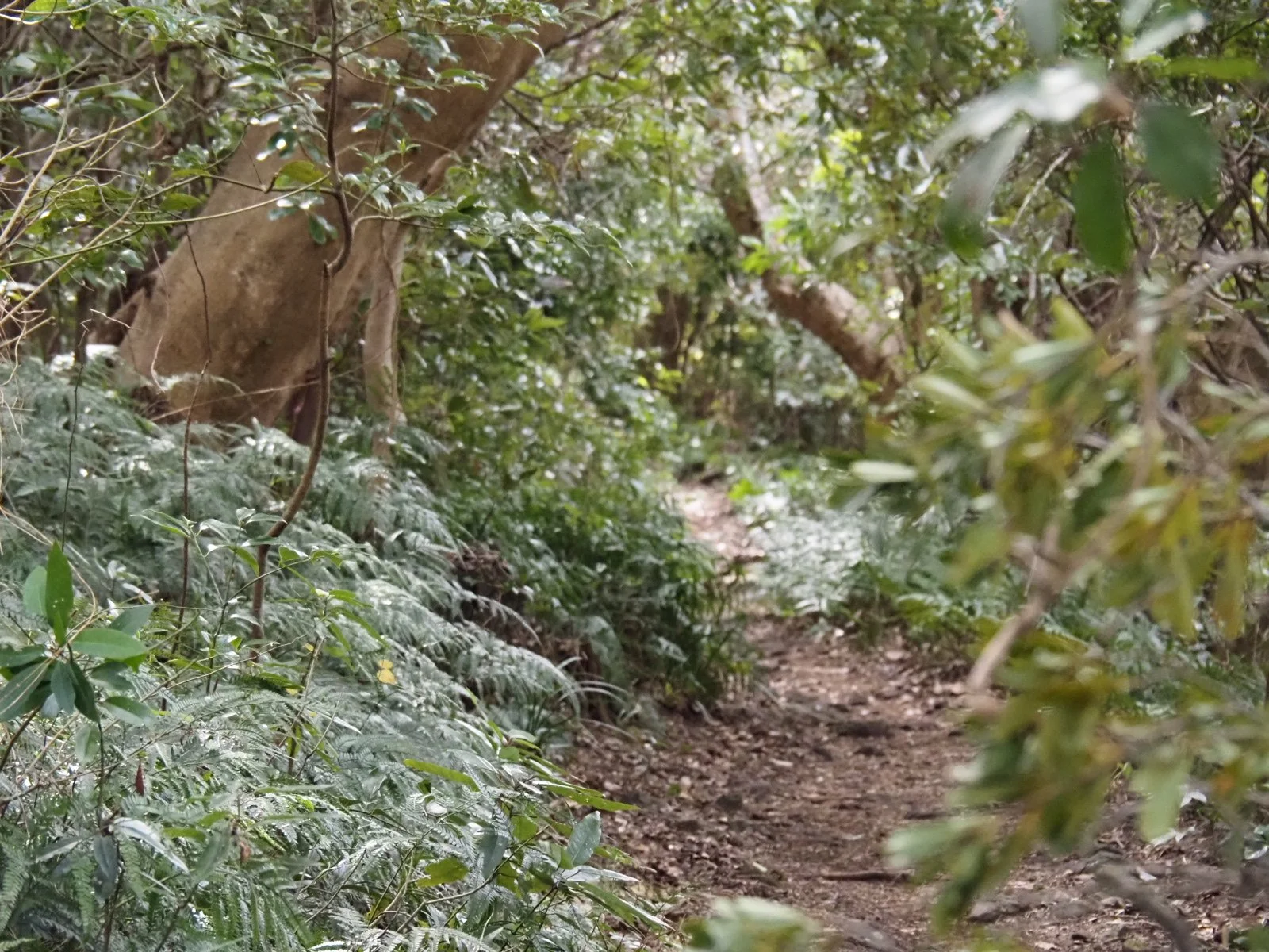
Level: 3/5 - Moderate. Excellent fitness is required. While the hike is neither long nor does it have a huge amount of elevation change, the truth is that this hike is deceivingly challenging. It is split into two sections, the “Picnical Route” and the “Nature Study Route”. The Picnical route is easy to walk. A lot of it is asphalted and very flat. The Nature Study part is quite the opposite and much more natural. Here the constant winding, uneven terrain make even the slight ups and down quite challenging as the hike goes on. So don’t underestimate it. The good news is there are points when you can quit and head back to the town.
Highlights:
Geology: The incredible rock hexagonal rock formations almost look too perfect to be created by nature.
Coastal views: As you hike, you can see incredible coastal views, and on a clear day you will get fantastic views of the Izu Shichito (the seven islands of Izu).
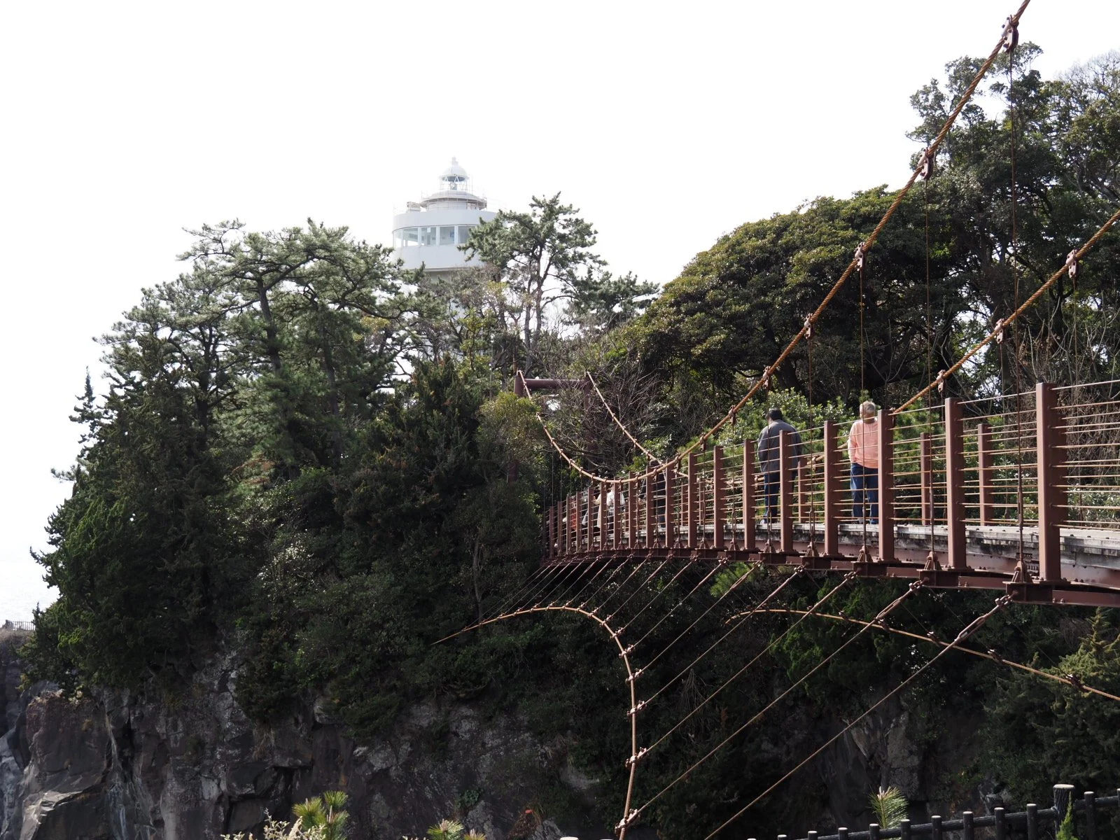
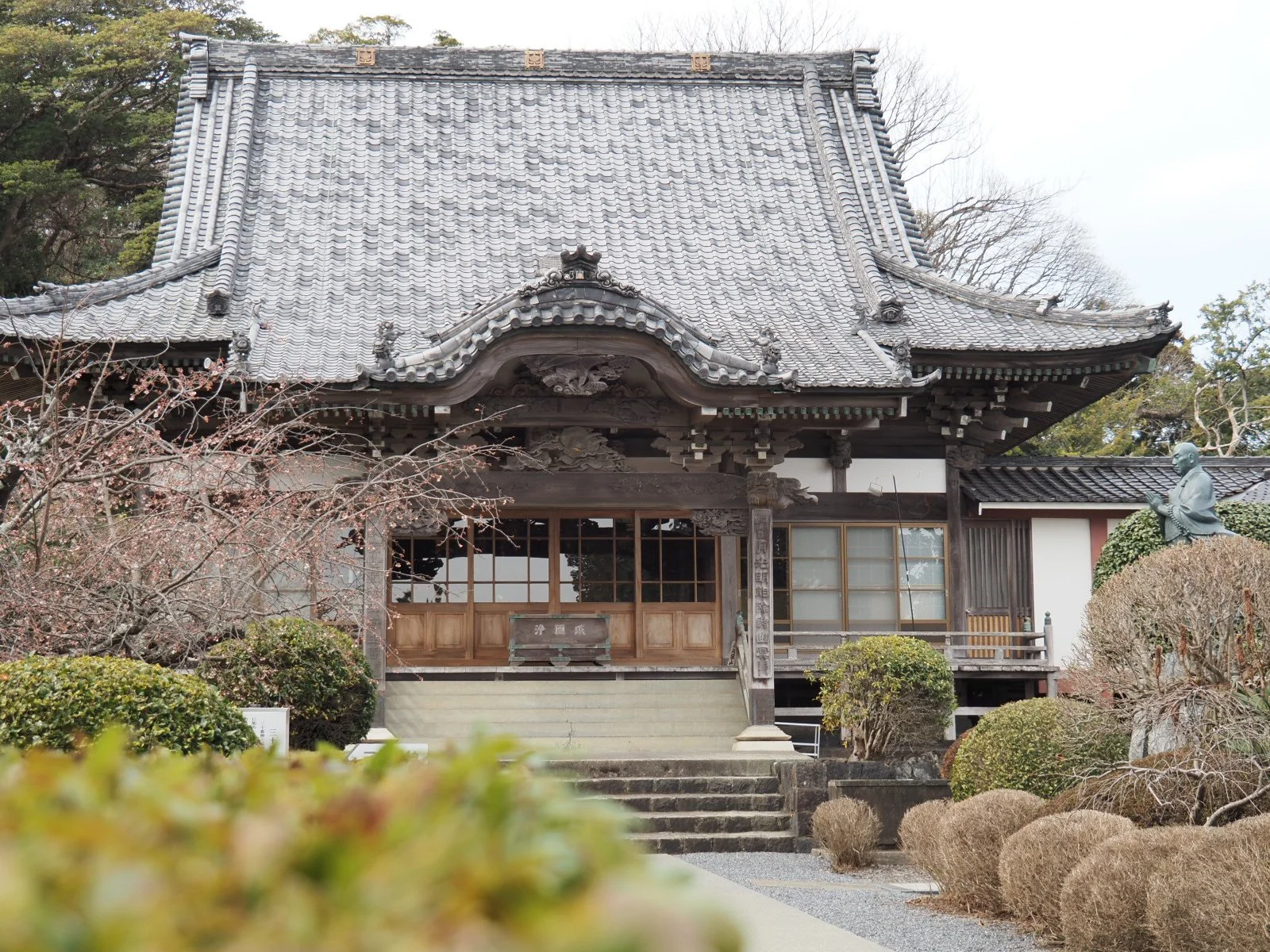
Cultural tidbits: It isn’t all nature. There are some really incredible cultural sites along the way.
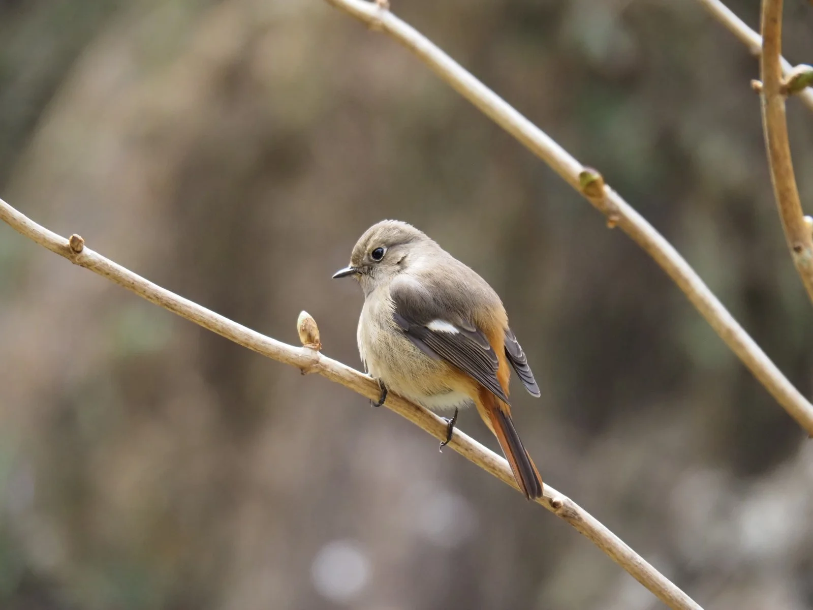
Animals: The trail is alive with birds and squirrels.
Points of Caution:
Rugged terrain: The Nature Study section of the hike especially has rough terrain so do be careful not to get injured while walking.
Wind/Waves: At high tide on certain days there can be rogue waves. Be careful and stay away from the water's edge.
Animals: In the warmer months there could be venomous snakes around. Be mindful of the mamushi (Japanese pit viper) on the trails. There are also wild boar though you are unlikely to see them in the daytime.
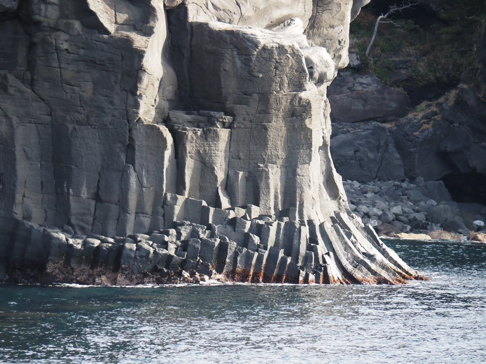
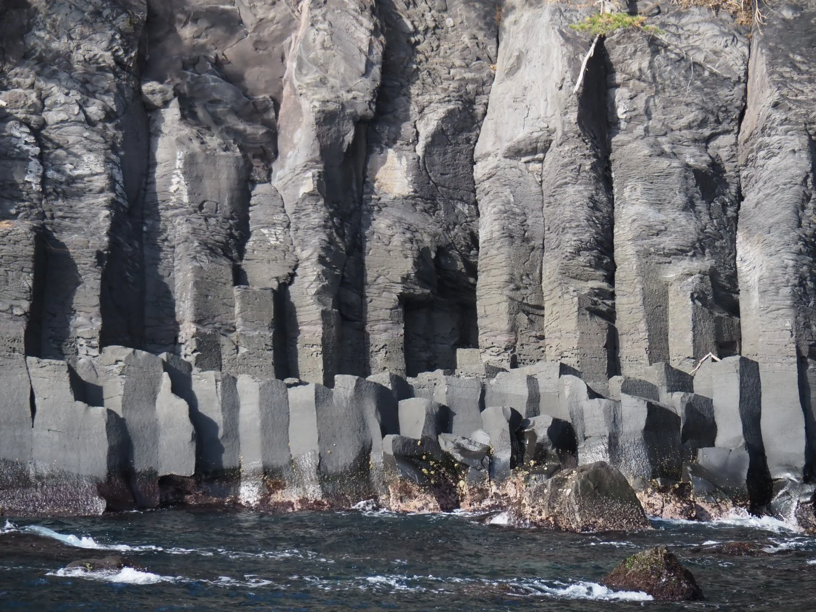
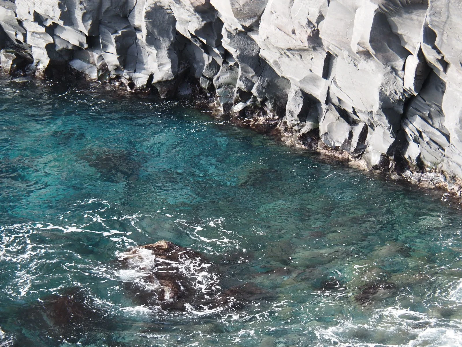
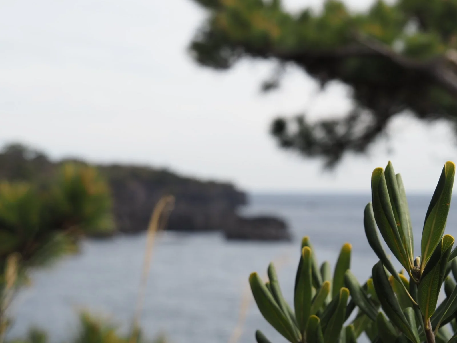
The coastline of Jogasaki is rich both in culture and nature, but especially the latter. The coastline itself was created about 4000 years ago, when nearby Mount Omuro erupted, spilling huge amounts of lava into the sea. The sudden cooling of this huge amount of white-hot lava caused the rock to contract and crack. This process created the incredible jagged columns of rock that the Jogasaki coastal hike is famous for. At specific points, the columns are almost perfect hexagons. The erosion then of the sea cut the cliff into an area of sheer and rugged beauty. The luscious deciduous and pine forests that surround you as you hike make the place feel all the more beautiful and a touch sub-tropical.
While the hike is neither long nor does it have a huge amount of elevation change, the truth is that this hike is deceivingly challenging. It is split into two sections, the “Picnical Route” and the “Nature Study Route”. The Picnical route is easy to walk. A lot of it is asphalted and very flat. The Nature Study part is quite the opposite and much more natural. Here the constant winding, uneven terrain make even the slight ups and down quite challenging as the hike goes on. So don’t underestimate it. The good news is there are points when you can quit and head back to the town.
Hiking the Jogasaki Coastline
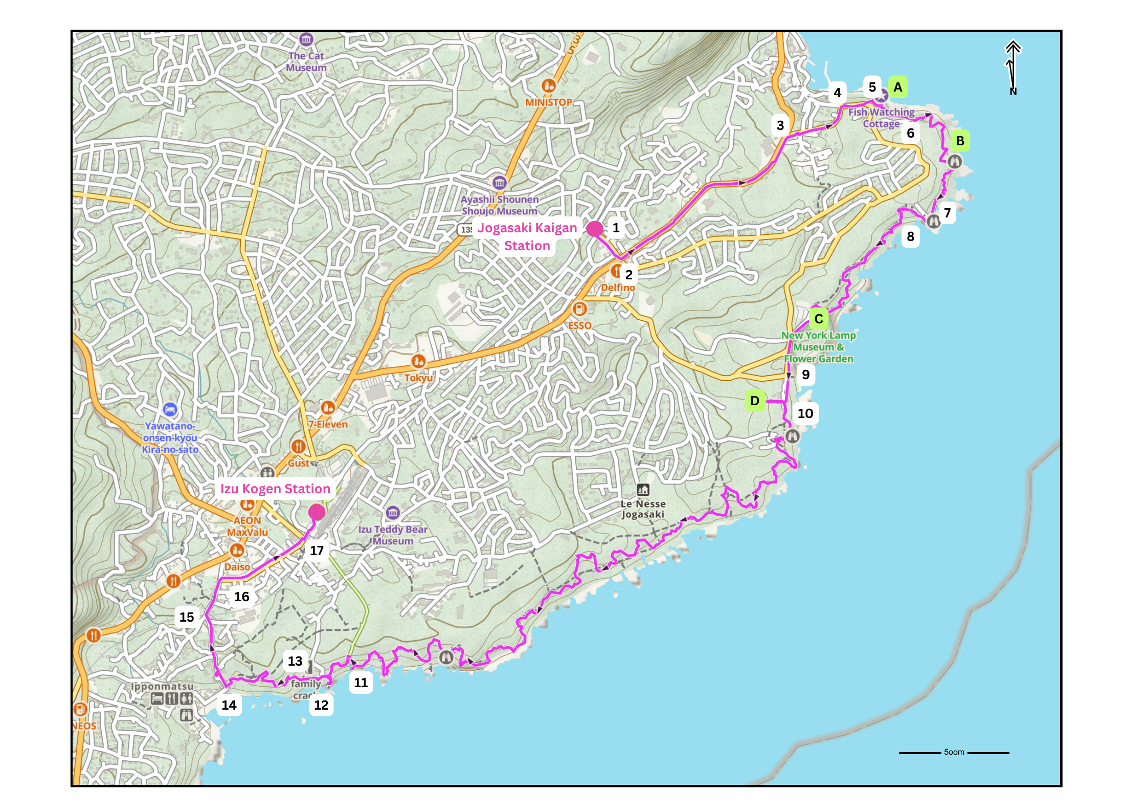
After getting off of the train at Jogasaki-Kaigan Station take the stairs/ramp down to the road and turn sharp right at the bottom.
In 200m turn left at the cross junction.
In 1km turn right.
In 300m turn right at the T junction.
In 100m turn off of the road and onto the trail following the signs to Uomi Goya and Bora Naya. You are now entering the trail. This first section of the trail is called the Picnical Course …